- Home Page /
- Electronics /
- GPS, Finders & Accessories /
- GPS System Accessories /
- Vehicle Mounts /
- SMA26 Plus GNSS Receivers Base&Rover RTK GPS ...
0 ratings


Item #:
69523748
SMA26 Plus GNSS Receivers Base&Rover RTK GPS Land Survey Equipment with Permanent Survey Software, Connect with Drone/UAV, 1cm Accuracy,PPP/NTRIP/UHF
89% of respondents would recommend this to a friend
Item #:
69523748
XCD 8304
Price Details
Excluding Shipping & Custom charges ( Shipping and custom charges will be calculated on checkout )
*All items will import from US
0 ratings
Write a review
In stock
QTY:
Only 10 items left in stock.
Order now and get it around Thursday, June 25
Secured transaction
Ubuy works hard to protect your security and privacy. Our advanced payment security system ensures confidentiality by encrypting your information during transmission using AES (Advanced Encryption Standards) and SSL (Secure Socket Layer) protocols. Your payment details are 100% secure as we do not share your payment details with third party sellers.
Our Top Logistics Partners
SMAJAYU R26 V2 GNSS RTK GPS Surveying Equipment provides 1cm accuracy and 5km distance with double R26 RTK GNSS receivers.
Fast
Shipping
Free
Return*
Secure Packaging
100% Original Products
PCI DSS Compliance

ISO 27001 Certified
Note: Step Down Voltage Transformer required for using electronics products of US store (110-120). Recommended power converters Buy Now.


What Stands Out
High Accuracy
Achieve pinpoint precision with 1cm accuracy for reliable surveying results, making it ideal for professionals needing exact measurements in various surveying projects.
NOAA Certified
This equipment meets NOAA certification standards, ensuring quality and reliability, which enhances credibility and professional trust in critical data collection tasks.
Advanced Technology
Equipped with 1408 channels and GNSS IMU RTK capabilities, this device offers exceptional performance in challenging environments, setting it apart from competitors in the surveying equipment market.
Product Details
- SMAJAYU R26 V2 GNSS IMU RTK GPS Surveying Equipment Rover Base Handheld
- R26-v2 Radio Protocol: CSS (Lora) protocol
- Radio range between rover and base: 5 kilometer
- R26 v2 GNSS Surveying System with IMU, ideal for construction and geodetic surveys
- Double R26 RTK GNSS receiver for precise measurement and reference locations
- Built-in Bluetooth, radio, storage, positioning, and inertial navigation modules
| Compatible with Vehicle Type | Car, Truck |
| Screen Size | 5 Inches (12.7 cm) |
| Additional Features | Bluetooth, Touchscreen, Waterproof |
| Connectivity Technology | Bluetooth |
| Map Types | Worldwide |
| Audio Output Mode | Digital |
| Battery Average Life | 2 days |
| Mounting Type | Tripod Mount |
| Resolution | 1 cm |
| Memory Storage Capacity | 32 GB |
| Touch Screen Type | Capacitive |
| Display Type | LCD |
| Human-Interface Input | Buttons |
| Compatible Devices | Smartphone, Tablet |
| Control Method | Push Button |
| Are Batteries Included | Yes |
| Supported Satellite Navigation System | GLONASS, GPS, Galileo, QZSS |
| Connectivity Protocol | Bluetooth |
| Sport Type | Static and Movable |
| Brand | SMAJAYU |
| Model Name | SMA26 Plus |
| Built-In Media | 1*Handheld bracket,1*Handheld Charger, 1*Tape Measure,1*Extension Rod,1*Disc, 1*User Manual, 2*GNSS receiver,1*Handheld controller, 2*Power Adaper,2*Terminal Antenna |
| Model Year | 2025 |
| Manufacturer | SMAJAYU |
| Model Number | SMA26 |
| Mfr Part Number | SMA26 |
| Unit Count | 1.0 Count |
| Item Dimensions L x W x H | 5.5"L x 5.5"W x 3.4"H (14 x 14 x 8.6 cm) |
| Item Weight | 19.84 Pounds (9 kg) |
| Vehicle Service Type | Car, Truck |
| Special Feature | Bluetooth, Touchscreen, Waterproof |
| Map Type | Worldwide |
| Included Components | 1*Handheld bracket,1*Handheld Charger, 1*Tape Measure,1*Extension Rod,1*Disc, 1*User Manual, 2*GNSS receiver,1*Handheld controller, 2*Power Adaper,2*Terminal Antenna See more |
| Battery Life | 2 days |
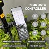
What's in the box
2*GNSS receiver,1*Handheld controller
1*Handheld bracket,1*Handheld Charger
2*Power Adaper,2*Terminal Antenna
1*Tape Measure,1*Extension Rod,1*Disc
1*User Manual
Who Should Buy?

-
Professional Surveyors
Ideal for professional land surveyors needing high accuracy and reliable GPS data for precise measurements.
-
Construction Engineers
Great for engineers in construction projects requiring accurate site measurements and real-time data collection.
-
Environmental Researchers
Useful for researchers conducting environmental studies that need accurate geospatial data for mapping and analysis.

-
Casual Users
Not suitable for casual or hobbyist users who require only basic surveying tools or less accuracy.
-
Budget-Conscious Buyers
Not ideal for those on a tight budget since it may be too costly compared to simpler tools.
-
DIY Projects
Not recommended for small DIY projects, as precision is not often crucial compared to professional needs.
Product Description
Have any Query? Chat with us
Customer Questions & Answers
-
Question:
What features make the NOAA Certificated SMA26 GNSS IMU RTK GPS Rover Base an effective surveying tool?
Answer: The NOAA Certificated SMA26 GNSS IMU RTK GPS Rover Base boasts high accuracy of 0.5cm over distances up to 10km. Equipped with advanced survey software, it provides real-time data collection and processing. Features like multiple frequency tracking enhance performance in challenging environments. This equipment is ideal for land surveyors needing precise measurements for construction, mapping, or environmental analysis. -
Question:
How does the 0.5cm accuracy benefit surveying applications?
Answer: Achieving 0.5cm accuracy means your measurements are exceptionally reliable, which is crucial in applications like boundary determinations, infrastructure planning, and topographic surveys. This high level of precision reduces errors that could lead to costly rework or legal issues, making it ideal for professional surveyors and engineers who rely on meticulous data for decision-making. -
Question:
What kind of survey software is included with the SMA26 GNSS IMU RTK system?
Answer: The SMA26 GNSS IMU RTK system comes with specialized survey software designed for efficient data collection and analysis. This software includes features like real-time visualization, data export options, and integration with CAD applications. Users benefit from a user-friendly interface that streamlines the surveying workflow, making it a great choice for both seasoned professionals and newcomers to surveying. -
Question:
What is the significance of having a 32GB storage in the surveying device?
Answer: A 32GB storage capacity provides ample space for storing detailed survey data, field notes, and multiple projects without the need to manage data frequently. This feature allows users to capture extensive data sets in one go, which is critical for large-scale projects. It ensures that surveyors can work uninterrupted, saving both time and effort during data management. -
Question:
Can the SMA26 GNSS IMU RTK GPS Rover function in various environments?
Answer: Yes, the SMA26 GNSS IMU RTK GPS Rover is designed to perform well in various environments including urban, rural, and mountainous areas. Its advanced signal processing capabilities enable successful operation even in conditions where satellite signals may be obstructed. This versatility makes it suitable for diverse surveying tasks, such as land development, environmental studies, and road construction. -
Question:
How easy is it to transport the SMA26 GNSS IMU RTK GPS Rover?
Answer: The SMA26 GNSS IMU RTK GPS Rover is designed with portability in mind. Its lightweight and compact design facilitate easy transportation to various survey sites. Whether you're transitioning between urban lots or vast landscapes, the Rover's convenience allows survey teams to work efficiently without the burden of cumbersome equipment. -
Question:
What are the practical applications for the NOAA certified SMA26 GNSS equipment?
Answer: This certified GNSS equipment is invaluable in numerous fields such as land surveying, construction layout, environmental monitoring, and agricultural planning. Professionals using this device can accurately gauge land features, plan construction projects with precision, and even monitor ecological changes over time. Its versatility aids in enhancing project outcomes and ensuring compliance with regulatory standards. -
Question:
What is RTK and how does it work in the SMA26 GNSS IMU device?
Answer: RTK stands for Real-Time Kinematic positioning, which allows for high-precision positioning using GPS signals. The SMA26 GNSS IMU utilizes a stationary base station that communicates with the rover unit to correct GPS signals in real time. This enables surveyors to achieve centimeter-level precision, making it a crucial feature for tasks requiring exact measurements. -
Question:
Where can I buy Surveying Equipment, NOAA Certificated SMA26 GNSS IMU RTK GPS Rover Base in Saint Kitts and Nevis?
Answer: You can conveniently purchase the Surveying Equipment, NOAA Certificated SMA26 GNSS IMU RTK GPS Rover Base Handheld Collector with Survey Software from Ubuy in Saint Kitts and Nevis. They offer a user-friendly platform for finding specialized survey equipment, ensuring that you can access this precise and efficient tool seamlessly.
SMAJAYU Vehicle Mounts SMA26 Editorial Review


The R26 RTK Surveying System Rover+Base is a highly reliable surveying system that comes with pre-activated activation codes, making it easy to use. It is equipped with a 1408 channel receiver and a LP80 controller that has permanent surveying software installed in it. The system's margin of error is 1 cm per point, which is reasonable for most surveying applications. The R26 RTK Surveying System Rover+Base is ideal for professionals and beginners in surveying and is capable of handling complex surveying tasks.
Customer Reviews & Ratings
28 customers ratings
-
5 Star
75%
-
4 Star
6%
-
3 Star
5%
-
2 Star
0%
-
1 Star
14%
Review this product
Share your thoughts with other customers
Pros
- Pre-activated activation codes make the product ready to use out of the box.
- The LP80 controller has permanent surveying software installed in it, reducing the need for additional purchases.
- The 1408 channel receiver provides accurate data for complex surveying tasks.
Cons
- Margin of error at 1 cm per point may not be suitable for high-precision surveying tasks.
Product Price History
Important information
- Limitations : For products shipped internationally, please note that any manufacturer warranty may not be valid; manufacturer service options may not be available; product manuals, instructions, and safety warnings may not be in destination country languages; the products (and accompanying materials) may not be designed in accordance with destination country standards, specifications, and labeling requirements; and the products may not conform to destination country voltage and other electrical standards (requiring use of an adapter or converter if appropriate). The recipient is responsible for assuring that the product can be lawfully imported to the destination country. When ordering from Ubuy or its affiliates, the recipient is the importer of record and must comply with all laws and regulations of the destination country.
- Not all the products listed on Ubuy are for sale, as Ubuy is a global search engine. Products are subject to export/trade regulations.
XCD 8304
Order now and get it around Thursday, June 25
This item is not restrict in my country.(Please click on above link if this item is not restrict in your country, So our team will review and allow.)
QTY:
Only 10 items left in stock.
Secured transaction
Ubuy works hard to protect your security and privacy. Our advanced payment security system ensures confidentiality by encrypting your information during transmission using AES (Advanced Encryption Standards) and SSL (Secure Socket Layer) protocols. Your payment details are 100% secure as we do not share your payment details with third party sellers.
Our Top Logistics Partners
Fastest cross-border delivery
Features & Benefits
- Features 1cm accuracy and 5km distance
- Comes with double R26 RTK GNSS receivers
- Fully supports BDS, GPS, GLONASS, Galileo systems
- Built-in Blue-tooth, radio, storage, positioning and inertial navigation modules
- Surveying software installed in handheld device
- Suitable for various surveying & engineering applications